Perring Parkway: A Historical Overview
Perring Parkway (MD Route 41) serves as a critical north-south artery in Baltimore, facilitating both commuter traffic and economic activity. Its development, however, unfolded in phases from the mid-1960s through the late 1980s, reflecting Baltimore's post-war suburban expansion and the burgeoning demand for improved transportation infrastructure. This piecemeal construction, while addressing immediate needs, may inadvertently contribute to present-day challenges. A lack of comprehensive, unified planning during the initial construction might explain some current inconsistencies in design and resulting traffic flow issues.
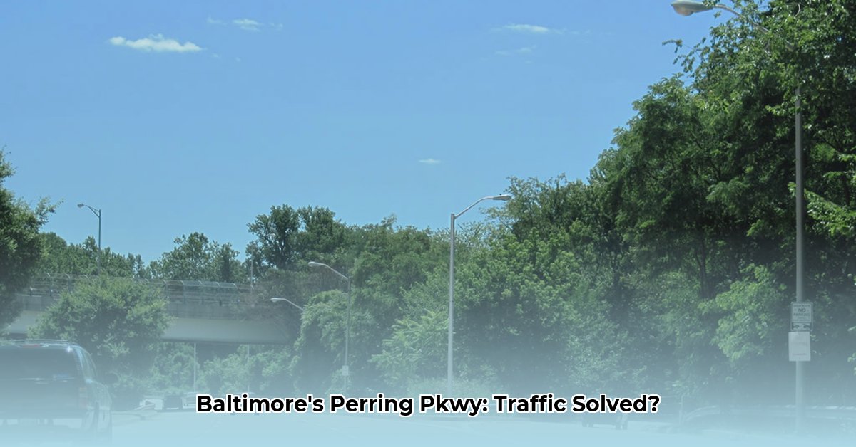
Current State of Perring Parkway: A Technical Assessment
Perring Parkway's configuration isn't uniform throughout its length. The southern sections feature controlled-access highway design, limiting entry and exit points. In contrast, the northern sections, beyond I-695, transition to an undivided highway allowing for more frequent access. This variance in design complicates traffic flow and potentially exacerbates congestion. The number of lanes also varies, ranging from four to six depending on location. Furthermore, inconsistencies in road signage further contribute to driver confusion and potential safety concerns. A comprehensive traffic study is urgently required to quantify these issues and inform effective solutions. How can we best optimize traffic flow across this varied roadway infrastructure?
Traffic Analysis: Data Gaps and Challenges
Currently, readily available, reliable data on Perring Parkway's daily traffic volume is limited. This data scarcity hinders a precise assessment of current conditions. While anecdotal evidence suggests significant rush-hour congestion, particularly at specific points, the lack of concrete data prevents informed decision-making. Consequently, a high priority should be placed on acquiring comprehensive and reliable traffic data to accurately inform and evaluate any proposed improvements.
Challenges and Opportunities: A Strategic Assessment
Perring Parkway faces several significant challenges:
Congestion: Recurring rush-hour congestion, with some areas experiencing near-constant gridlock, significantly impacts commute times and overall efficiency. How can we effectively alleviate this congestion, given the existing infrastructure?
Aging Infrastructure: Decades of use have resulted in significant wear and tear on the roadway surface and underlying systems. Maintaining the existing infrastructure requires substantial investment and consistent upkeep.
Lack of Multimodal Options: The current infrastructure lacks adequate provisions for pedestrians and cyclists, limiting access and discouraging alternative modes of transport. What are the optimal solutions for integrating safer pedestrian and bicycle-friendly infrastructure into the existing roadway?
These challenges, however, also present significant opportunities for improvement. Investing in Perring Parkway's upgrade isn't merely about addressing existing problems; it's about building a more efficient, resilient, and sustainable transportation system for the entire Baltimore area. How can we leverage these opportunities to create a truly modernized transportation corridor?
Stakeholder Engagement and Proposed Solutions
Various stakeholders are actively engaged in Perring Parkway's future planning:
Maryland State Highway Administration (MDSHA): MDSHA is focused on conducting a comprehensive traffic study and undertaking essential maintenance repairs in the short term. Long-term goals include developing a comprehensive transportation plan encompassing capacity improvements and multimodal enhancements.
Baltimore County Government: The county government is evaluating opportunities for transit-oriented development and exploring "smart" infrastructure solutions, such as adaptive traffic signals.
Baltimore City Department of Transportation: The city's department of transportation prioritizes improving pedestrian safety, particularly near Hillen Road, and integrating Perring Parkway planning into broader city mobility strategies.
Local Communities: Local communities are advocating for active participation in the planning process, emphasizing sustainable transportation options to minimize environmental impact and improve overall quality of life.
A Multi-Phased Approach to Perring Parkway Improvement
A successful Perring Parkway upgrade requires a multi-phased approach:
Comprehensive Data Acquisition: Conduct a rigorous traffic study to fully understand existing traffic patterns, congestion points, and driver behavior. (Estimated Completion: 12 months)
Strategic Master Planning: Develop a comprehensive, long-term plan encompassing infrastructure improvements, multimodal integration, and sustainable design elements. (Estimated Completion: 18 months)
Community Engagement: Establish robust channels for community input and feedback throughout the planning and implementation phases. (Ongoing)
Phased Implementation: Prioritize improvements based on urgency, impact, and available resources, implementing changes over a series of phases. (Ongoing)
Ongoing Monitoring and Evaluation: Continuously track the effectiveness of implemented improvements and make necessary adjustments to optimize performance and safety. (Ongoing)
Conclusion: A Vision for Baltimore's Future
Perring Parkway holds the potential to become more than just a roadway; it can be a vital connector that enhances Baltimore's mobility and sustainability. By embracing a data-driven, community-centric, and innovative approach, we can transform Perring Parkway into a safer, more efficient, and environmentally conscious transportation artery, benefiting all residents and contributing to a brighter future for Baltimore.